Using GIS Mapping and Local Geology in Earth Science for NGSS
Join us for dinner and a workshop!
Wednesday, March 16, 2016 5:00 - 8:00 pm at the Center for Professional Studies in Towson, MD
Maryland has a billion-year geologic history, resulting in a wide variety of geology that can be used to teach geologic principles while making them locally "under-your-feet!" relevant. And computer maps using online geographic information systems (GIS) web maps (only need a browser to use) can bring the data to your classroom, so students can do their own discoveries and analysis in accord with NGSS expectations. So come learn some regional geology and experience the power of GIS - yes, you can open it in class the next day - as we work through some lessons geared to NGSS PEs to understand how Maryland was made.
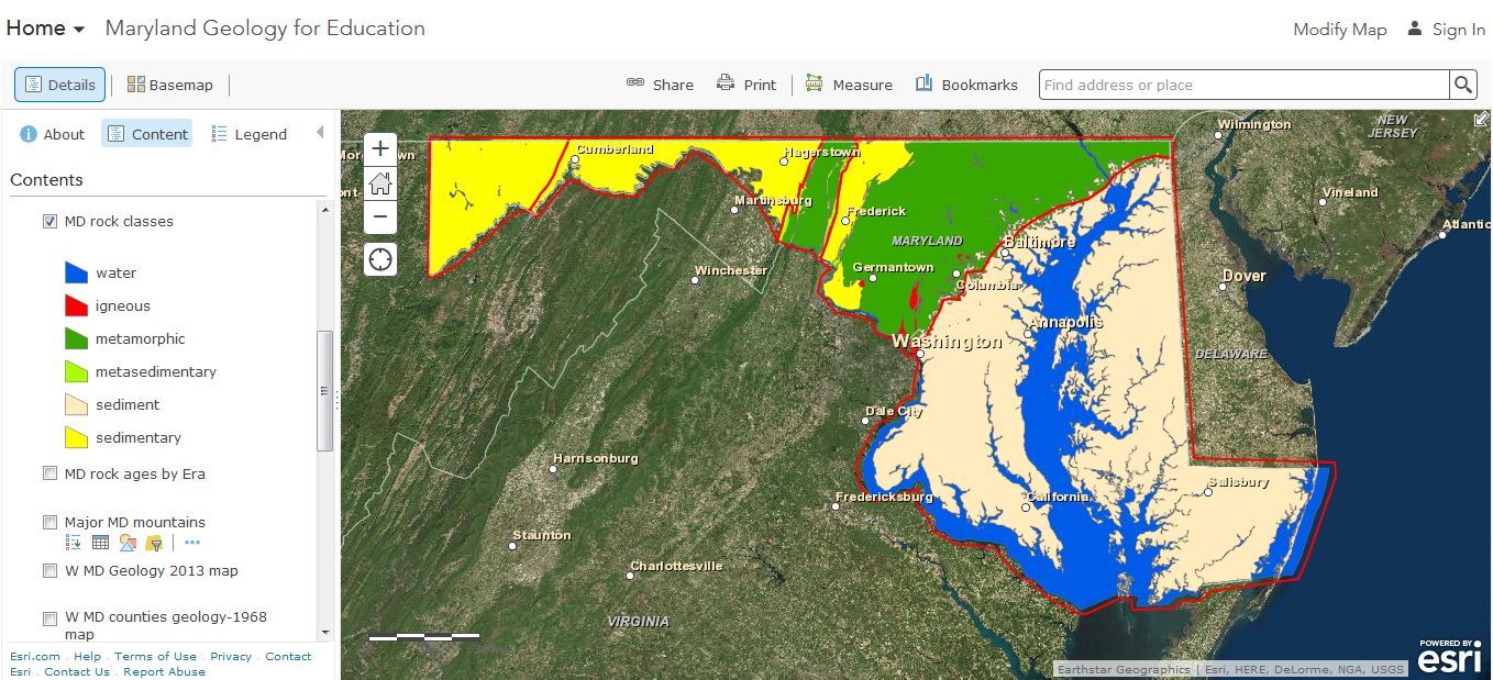
Martin Schmidt, author of the book, Maryland's Geology, will go over a set of lessons keyed to NGSS performance expectations that he has written on the landforms, geology, and geologic history of Maryland, and in the process review these subjects; the lessons will be available in Word format so teachers can edit them as needed for their own classes. The lessons use a web map with many GIS layers for Maryland: geologic maps, streams & watersheds, elevations, physiographic provinces, state & local parks, rock classes (igneous, sedimentary, metamorphic), and rock ages; this map only needs a browser to view and is publically available. Martin Schmidt has been a teacher at McDonogh School in Owings Mills, MD since 1978, teaching physics, chemistry, and Earth sciences.
This event is geared mainly toward middle and high school science teachers, but teachers of all levels are invited. Computers will be available for use during the workshop.
When: Wednesday, March 16, 2016 from 5:00 PM to 8 PM.
The event will begin at 5:00 pm, with MAST providing dinner until 5:30 pm. The workshop will begin at 5:30 pm and the program will end at 8:00 pm.
Where: Towson University Center for Professional Studies facility, 7400 York Road, Towson, MD. Note this is adjacent to, but not on, Towson's main campus. Free parking provided at the rear of the building. Click here for google maps location.
Cost (includes dinner):
$10 for MAST members
$15 for non-member students. Includes a one-year membership to MAST.
$25 for non-members of MAST. Includes a one-year membership in MAST.
Registration: Pre-registration is required. Register here. On-line payment instructions will be provided at registration and payment must be received no later than March 13.
Questions: If you have any questions about the event or registering, please contact Mary Stapleton at mkstapleton@towson.edu.